
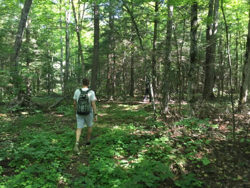
Discover dozens of diverse trails, hundred kilometres ready to be trekked, as well as parks and conservation areas suitable for beginner adventurers, mountain bikers, avid birdwatchers, and seasoned nature enthusiasts alike.
View the Cycling & Trails Map here
Keeping it Short
Trails are a wonderful way to explore the outdoors and all you have to do is follow the path… or make your own. If you’re in a hurry but need a breath of fresh air, these short routes are for you!

SELWYN
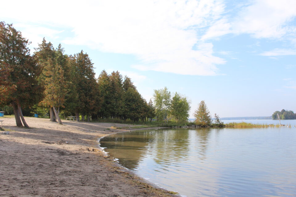
B.E.L. Rotary Bridgenorth Trail
B.E.L. Rotary Bridgenorth Trail is 2.3 kilometres long, lined with native trees, and boasts a peaceful and tranquil setting amidst the Miller Creek Wetlands. There are benches situated along the Trail to provide scenic and comfortable resting spots as needed.
SELWYN
Ennismore Heritage Trail
There are 3 loops with a total trail distance of about 4km including boardwalks, a picnic shelter, an osprey platform and interpretive signage. The Trails are located throughout Ennismore Waterfront Park.
ASPHODEL NORWOOD
Mill Pond Forest Trails
This short but sweet trail system offers three route options ranging from 200m to 900m in length. With a picnic area and beautiful views of Mill Pond, this is a great spot for a family of all ages.
CAVAN MONAGHAN
Millbrook Valley Trails
The Millbrook Valley Trails are a passive use walking trail starting from Medd’s Mountain Conservation Area and looping around Millbrook through the Oak Ridges Moraine.
PETERBOROUGH/DOURO-DUMMER
Trent University Wildlife Sanctuary Nature Area
This nature area features 3 loop trails; the Red Trail (1.9 km), the Yellow Trail (2.4 km), and the Blue Trail (2.9 km). Slip on your hiking boots or grab a pair of cross-country skiis for this triple trail treat.
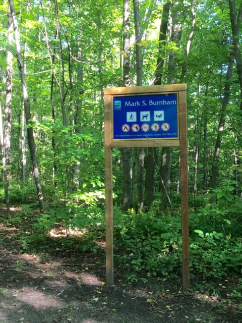
OTONABEE–SOUTH MONAGHAN
Mark S. Burnham Trail
Mark S. Burnham Provincial Park features 2.4 kilometers of trail featuring some of the oldest maple, beech, elm and hemlock groves in Ontario. Try out this short hike located in the middle of the Peterborough Drumlin Field to visit more than 3,000 of glacial remnants and stunning fall colours.
HAVELOCK-BELMONT-METHUNE
Mathison Conservation Area
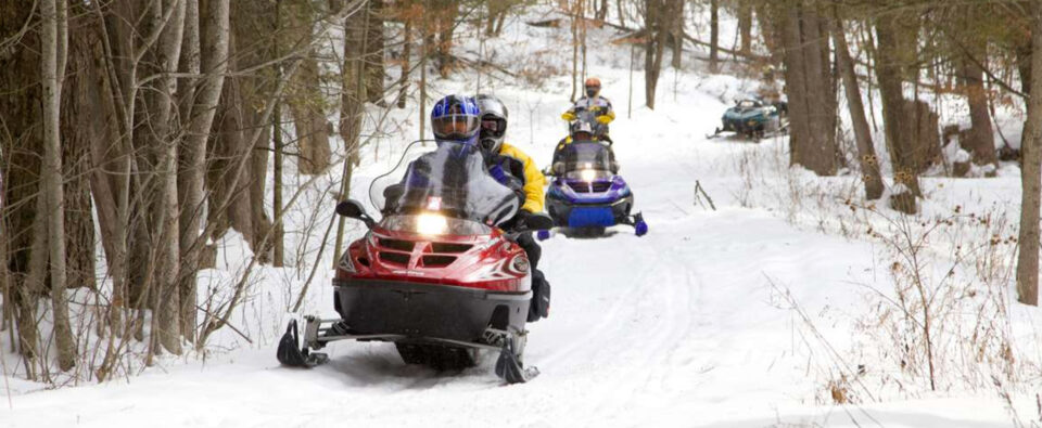
This area is made up of 250 acres of scenic forests and wetlands located north of Havelock. It has 1.6 kilometers of multi-use trails for walking, biking, and snowmobiling use and 1.1 kilometers of walking only trails. ATVs are not permitted on this property.
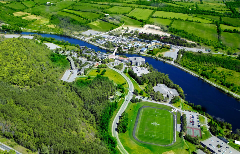
CITY OF PETERBOROUGH
South Drumlin Loop
This short 3.4 kilometer loop features views of the Trent Canal and a visit to the abandoned rail bridge near Trent University. A great option for all skill levels and visitors to the Trent University campus.
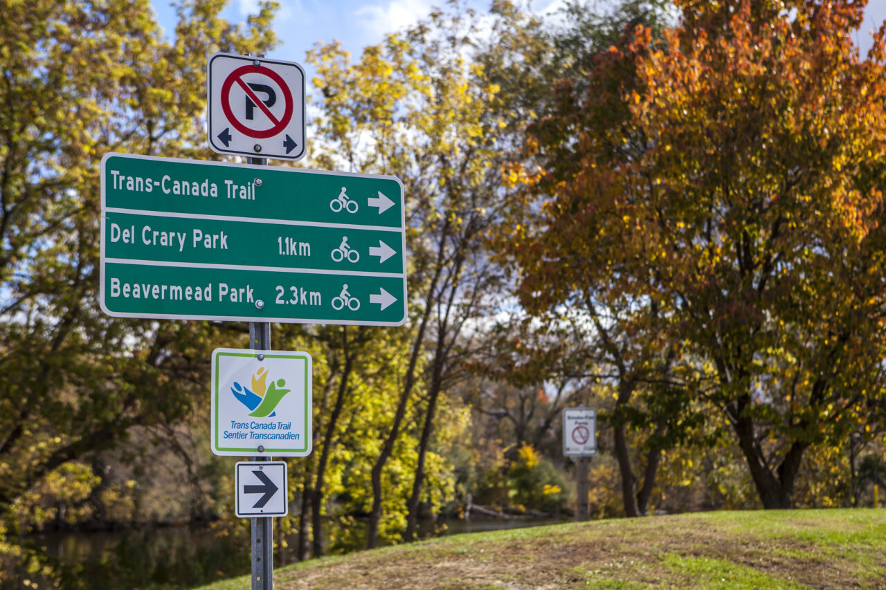
In it for the Long Haul
Do you need a break from the indoors? Looking for more than just a quick jaunt? Then these trails are for you! The world’s longest recreational trail—which runs 23,000 kilometres across Canada—runs right through Peterborough & the Kawarthas on its way to the Pacific coast, called the Trans Canada Trail.
NORTH KAWARTHA
Petroglyphs Provincial Park
Largest known concentration of Indigenous rock carvings (petroglyphs) in Canada, depicting turtles, snakes, birds, humans and more; this sacred site is known as “The Teaching Rocks”. There are 3 trails between 5 and 7km long.

OTONABEE-SOUTH MONAGHAN
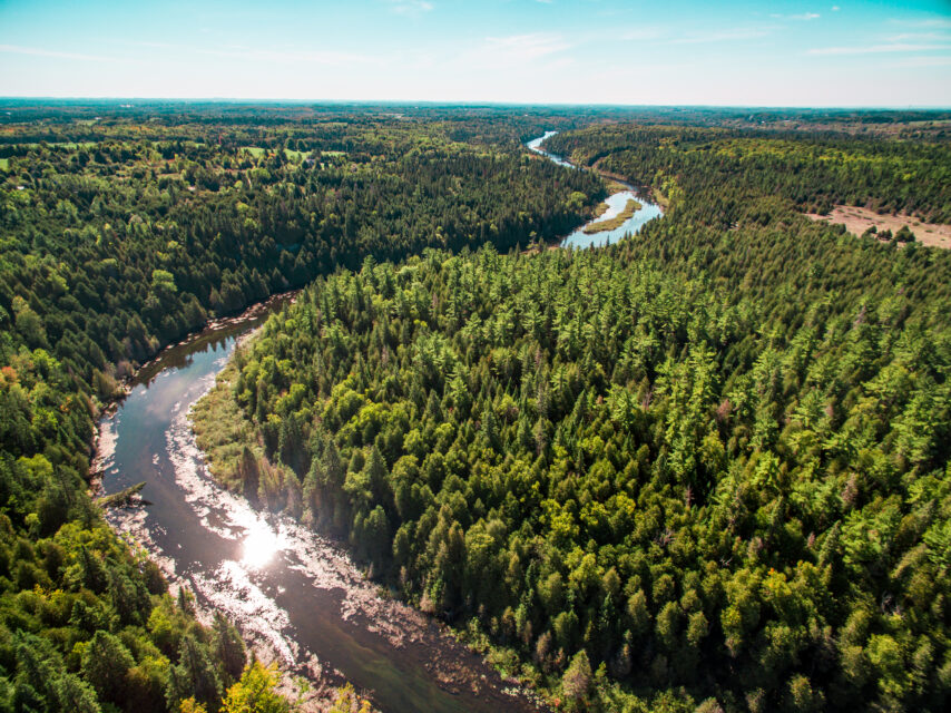
Lang to Hastings on the Trans Canada Trail
Travelling along the 33 km (one way) trail is an adventure unto itself; from passing alongside horses and farm animals grazing in the fields to a beaver dam that acts as a home to numerous furry little creatures. The trail leads you through a large culvert before taking you along the Trent Canal, leading you to the Village of Hastings.
DOURO-DUMMER
Warsaw Caves Conservation Area
Wander through Warsaw Caves with over 13 km of hiking trails to enjoy or explore the 800 metres of caves. Meander through forests and across open limestone plains. From the scenic lookout, you can view the Indian River valley. Along the Lookout Trail you’ll also see potholes and kettles and hear the sounds of the disappearing river.
SELWYN
Lakefield Trail
The Lakefield Trail is a 8.5 km trail which connects to the Trans-Canada Trail via the Peterborough County Rotary Trail. All sections of the this multi-use trail are fully accessible with historical interpretive signs that take you back in time, as they tell the story of Lakefield’s notable literary past and canoe building heritage. Tour along the eastern portion of the Trail can include a side trip through Lakefield’s thriving business section or, for a more natural setting, visit the west side of the Otonabee River as the Trail follows the southern tip of Katchewanooka Lake.

OTONABEE-SOUTH MONAGHAN
Harold Town Conservation Area
Harold Town Conservation Area offers a network of trails, available for off-road cyclists and hikers. Currently, the Trail Network consists of a circular loop of wide open double track trail, with connecting trails of flowy bermed single-track, technical rock gardens, switch-back climbs, rock pile features, log hops, bridges, small rock drops and tight turns. With over 10 kilometers of trails, Harold Town Conservation Area trails are ideal for both quick spins or combined laps for epic adventures.
NORTH KAWARTHA
Stony Lake Trails
The 10-kilometer trail network boasts scenic views of Stony Lake, with benches and resting areas available throughout. The trails are suitable for those with moderate and intermediate hiking experience and there are many opportunities to observe the abundant and diverse wildlife in this area. The loop follows trails that are very well marked including QR codes with ecological and geological info signage for interpretation. The trail follows a most mixed forest, with some meadow, beautiful rocky outcroppings. You will follow a mix of blue, yellow, red and brown trails.
SELWYN
Selwyn Conservation Area
Selwyn Beach Conservation Area is located on the northeast shore of Chemong Lake and is best known for its excellent swimming provided by a gently sloping sandy beach. The conservation area also offers a boat launch and docking facility, a large picnic shelter, group camping area and hiking trails. The trail passes through a variety of habitats, ranging from wetland to woodland and open field. It provides an excellent opportunity for visitors to discover a variety of plants and wildlife in their natural environments.

SELWYN
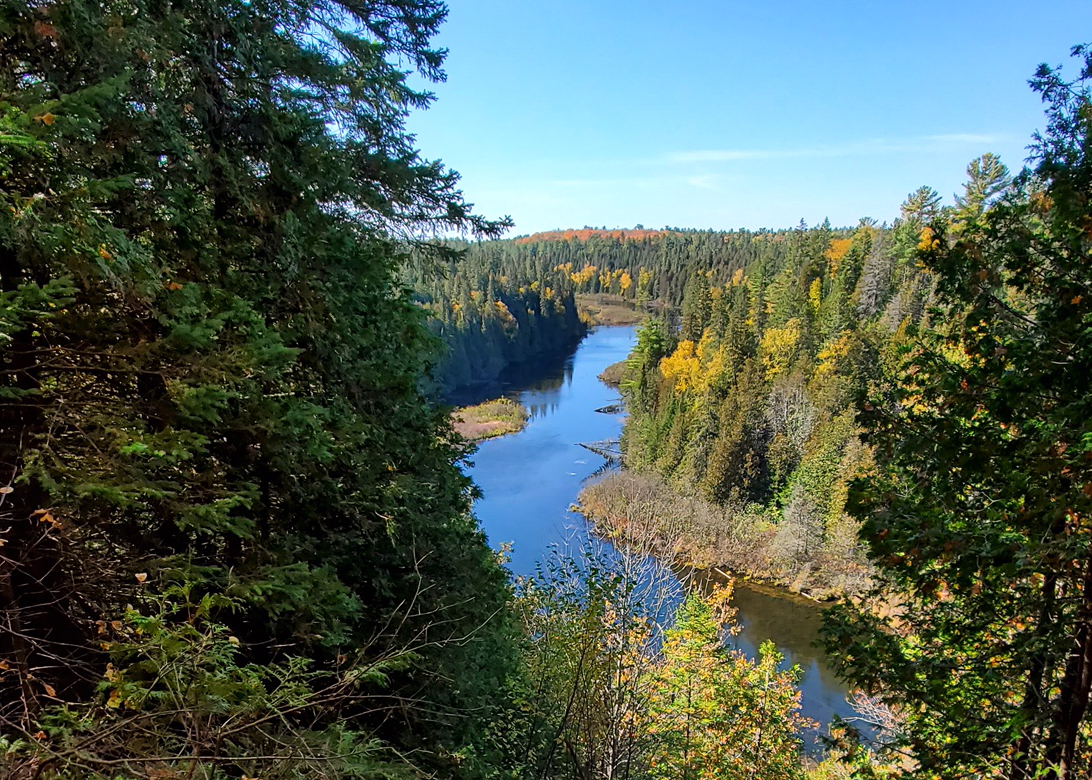
Eels Creek to High Falls
This hike along the southernmost section of the Canadian shield has some great views that can normally only be found further north. The trail starts out easy but becomes marshy around 300m in which is followed by a creek crossing. There are a few logs across the creek to aid in crossing but it’s still a little tricky. The trail then climbs onto open rocky sections of the Canadian shield as it follows the river upstream towards the falls. This area is home to Ontario’s only native lizard, the five-lined skink. This hike is on Crown Land so there are no fees and camping is permitted but be aware that there are no outhouses or other amenities.
OTONABEE-SOUTH MONAGHAN
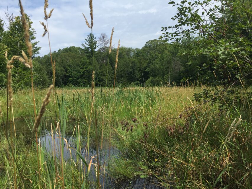
Birdsall Wildlife Area
Birdsall Wildlife Area is a 242.9 hectare property that is managed for the protection and conservation of important ecological features and valuable wildlife habitat. The property includes a Provincially Significant Wetland and an Area of Natural and Scientific Interest (ANSI), this area provides habitat for a wide variety of species.
DOURO-DUMMER
Robert Johnston EcoForest Trails
Enjoy 4 different trails with approximately 6km of walking trails. These trails consist of a pond, wetlands, brush piles, beech trees, hardwood forest, white ash, drumlin/red pine forest, rock piles, cedar forest, dog strangling vine and more.